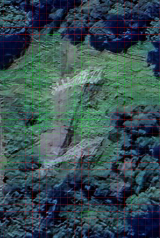
Vegetation Encroachment Detection
This project is designed to detect and monitor vegetation encroachment on power lines and other critical infrastructure. It leverages computer vision and machine learning techniques to analyze satellite imagery and identify areas where vegetation is growing too close to the infrastructure, potentially causing safety hazards and disruptions to power supply.
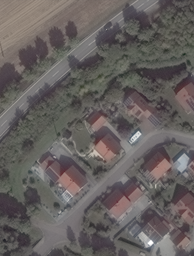
Solar Panel Detection and Calculation of Area covered by Solar Panels
This project is designed to detect and calculate the area covered by solar panels in a given image. It leverages computer vision and machine learning techniques to analyze satellite imagery and identify areas where solar panels are installed.
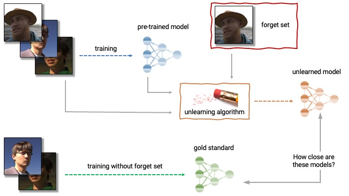
Deep Unlearning of a particular class from a multi-class set.
This project is designed to remove a particular class in our case Elephant class from a multi-class set(Animal class). It leverages machine learning techniques to analyze the data and identify the class to be removed.
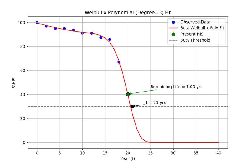
Remaining Life Assessment of Electrical Assets using Health Index and Machine Learning
This project is designed to assess the remaining life of electrical assets using health index of the asset. It uses regression models to plot the remaining life curve.
AstroGrid
This project is designed to efficiently process and track the positions of up to 30,000 satellites using Two-Line Element (TLE) data. It calculates satellite positions over time, converts these positions from Earth-Centered Earth-Fixed (ECEF) coordinates to latitude, longitude, and altitude (LLA), and filters the data based on user-defined geographical regions. The project is optimized for performance using GPU acceleration (via CuPy) and distributed computing.
Business Data Management - Optimising the Sales of a Medium-Scale Grocery Shop
The primary objective of the capstone project is to augment net profit, optimize inventory, and
establish effective control over goods flow. To achieve this, an in-depth analysis of sales data,
coupled with fluctuations in purchase prices throughout the month, will be conducted.
Identifying gaps and areas for improvement in the existing strategy will be a critical
component of the project.
Autonomous Car with Lane Detection
This project leverages OpenCV to implement a real‑time road lane detection system. It processes live video feeds using advanced image processing methods—such as color space conversion, edge detection, and the Hough transform—to accurately identify and highlight lane markings on the road. By dynamically adapting to varying lighting conditions and road geometries, the system not only enhances driving safety but also serves as a foundational step toward developing autonomous driving and advanced driver-assistance systems.
Hand Tracking: Screen Brightness Control System
This project is a real‑time hand gesture-based screen brightness controller that utilizes computer vision and gesture recognition to enhance user interaction. Using OpenCV in combination with MediaPipe, the system detects and tracks hand landmarks from a webcam feed, calculating the distance between key fingertips to determine the desired brightness level. This distance is dynamically interpolated to adjust the screen's brightness via the screen_brightness_control library, resulting in an intuitive, touch-free method to control your display.